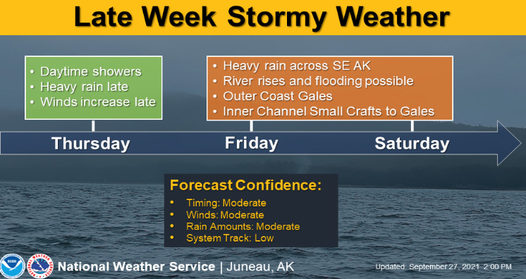
As HSC’s first WRN Ambassador post, looks like there is a strong storm coming this weekend. The timing and strength is not certain yet, but confidence in it is increasing. We’ll keep you up to date as we know more. As of right now, it’s just something to plan for. Keep an eye on those drainages (provide before and during pictures, if safe to do so). Again, as of right now, this is just a typical storm coming through but looks to be more windy than most. More information from the National Weather Service is below and at https://www.weather.gov/ajk/.
Here are the key points:
- Potential for a strong storm impacting SE AK this weekend.
- Heavy rain and high wind gusts upwards for 60 mph over land are possible.
- Potential for flooding due to the additional rain and currently saturated ground. Increased possibility of mudslides.
- Gale force winds over inner channels.
- Storm force winds with 20 foot or higher seas over the AK Gulf.
- While there is still some question on the exact timing and strength of the system, confidence is increasing.
- Please stay alert for more information through the week.
Products of interest at:
- Special Weather Statement
- Forecast Discussion
- Public Forecasts
- Inside Waters Forecasts
- Outside Waters Forecasts
- Local Aviation Forecasts–Interactive Map
- Forecast Graphics
There may be other resources available for you on WFO Juneau web page, check it out.


